Gnarl Ridge
It had been a long time since I’d been up to Gnarl Ridge on Mount Hood’s east side. Almost six years, to be exact.
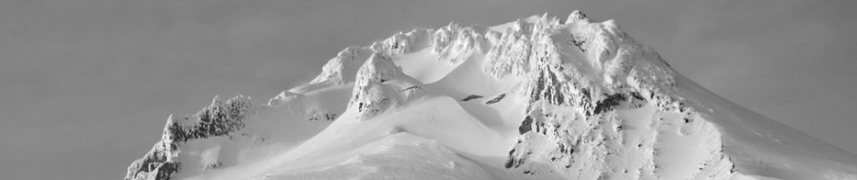
In fact, the last time I was up there, Amy and I were coming around the mountain from Cooper Spur on day four of our trip on the Timberline Trail. It was the first time I’d really been up that high on that side of the mountain and taken in such a unique perspective of it. From up there, Hood is massive, sprawling and broad, not at all like the textbook spire you see from the west or north.

Coming down Gnarl Ridge on the Timberline Trail in 2005.
And if there’s a ridge more aptly-named than Gnarl Ridge on the entire mountain, I have yet to find it. Its craggy spine is littered with crumbling gray, black, and red volcanic rocks. Its steep southern edge ends in a sheer, unstable plunge hundreds of feet down to the canyon of Newton Creek below, and the stunted trees — whitebark pines — that cling to the ridge just at timberline have been ravaged by the wind and the snow up there. The live ones look perpetually bent and braced for the next gust; the dead ones, bleached and stark, look like boney hands reaching up out of the ground.
Gnarly, indeed.
I ended back up on Gnarl Ridge this past weekend almost by accident, as the original plan had been to walk the mostly leisurely two-and-a-half miles to Elk Meadows and spend the night there. (I’d not been there since our Timberline Trail trip in 2005, either. The spot played a big role in how that hike ended up playing out, which I write about in my book.) But once Oliver, my friend Wyatt, and I got to the sunny meadows, we still had plenty of energy and daylight to press on, so we did.
We walked through the woods up from Elk Meadows and just enjoyed being outside in the finally summer-like weather. Just a week earlier, we’d hiked to the top of Silver Star Mountain through rain, mist, clouds, and a chill that was more mid-March than mid-July. Right about 5,500 feet, we hit some snow, but the trail revealed itself just often enough that we were able to keep on track. (A little GPS assistance kept us true as well.)
There were some decent campsites with partial views of Hood that would have worked fine if there’d been nothing else, but after Wyatt headed back down, Oliver and I trudged up to the top of Lamberson Butte — named for early Mazama Lewis Lamberson — surveyed the incredible views, and found some even better spots to pitch a tent.
So we spent a quiet night on Gnarl Ridge, watching the sun set on Hood, Jefferson, the Sisters and Bachelor, listening to the creek shush and the valley slowly erode with the rumble of a random boulder every so often.

The nighttime stars were immaculate. Off to the east, a Gorge wind farm pulsed faintly every ten seconds, puncturing the distant darkness with red pinpricks like Christmas tree lights. And in the morning, I somehow woke up just as the sun was rising, coloring the mountain and everything around it in a clear, golden glow.
It was good to be back on Gnarl Ridge.

Sun’s out
After an insufferable amount of gray sky this spring, including an impenetrable bit last weekend that kept my Atlanta friend and his wife from seeing Mount Hood during a three-day visit, the sun has finally won out. It’s beautiful in Portland today, it looks bluebird up at the mountain, and at least as of today, the forecast looks like more of the same for the next few days.
Time to go for a hike.
But because this year has been such a precipitation-filled one, many of the best hikes around the mountain are still buried under feet of snow. According to the Natural Resources Conservation Service, which monitors snow levels among other meteorological statistics, there’s still more than 12 feet of snow at 5,400 feet on Mount Hood, more than 7 feet at 4,400 feet on the north side, and still close to 3 feet south of the mountain at 3,800 feet.
Not to fear. There are still plenty of low-elevation walks close to the mountain that can scratch the hiking itch. And if you don’t mind a little snow (or a lot) and are confident and capable on snowshoes, there shouldn’t be much to keep anyone off the trails now that some good weather is at least temporarily here. (Disclaimer: This blog is for information only. Hike at your own risk and only within your own abilities and comfort levels.)
A few of my springtime favorites:

Silcox Hut at about 7,000 feet on the south side of Mount Hood.
Palmer Snowfield: Nothing like a slog up the lower end of Hood’s South Side climbing route to take in the mountain on a clear day and wake up the climbing legs. It’s a mile and about 1,000 feet in elevation up fromTimberline Lodge to Silcox Hut, and another mile-plus and about 1,500 more feet up to the top of the Palmer ski lift. Start from Timberline and walk up along the east edge of the ski area.
Salmon River: An easy stroll along the pristine Salmon River, one of five major rivers that call Mount Hood as their source, the Salmon River trail cuts through a massive old growth forest with cedars of unfathomable girth. The entire trail runs about 7 miles, but you can hike in just as far as you’re up for and still get the wilderness gist. More information.
Hood River Mountain: This one’s a little ways away from the mountain, just outside Hood River, but its view of the peak and the entire Hood River Valley is simply jaw-dropping. Just three miles roundtrip and 600 feet up, Hood River mountain affords you a view that usually takes a lot more effort to attain. More information.

Summit of Hood River Mountain, September 2006.
Guidebooks
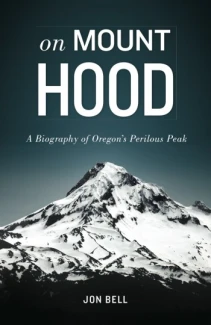
While there really aren’t that many books out there that tell the story of Mount Hood — Jack Grauer’s essential “Mount Hood: A Complete History” and Fred McNeil’s “Wy’East: The Mountain” notwithstanding — there are quite a few great hiking books that can really show people how to get to know the mountain through exploration.
Among my favorites are three from Oregon author and lifelong hiker Douglas Lorain.
 I first saw one of Doug’s slideshows probably 10 or 12 years ago at a regular meeting of the Ptarmigans, a Vancouver mountaineering club that has since gone on indefinite hiatus. It was all about his newest and maybe first book, “Backpacking Oregon.” Filled with trips all across the state, it also contains the definitive description and itinerary for the Timberline Trail on Mount Hood. Even though that hike, as mentioned yesterday, is supposedly no longer possible as a single loop, it was still in good shape in 2005, when Amy and I did it. “Backpacking Oregon” helped us plan our trip, stay on track, and have a memorable time.
 Lorain is also the author of “Afoot & Afield: Portland/Vancouver, A comprehensive hiking guide.” It’s a thick tome of more than 200 hikes within an hour’s drive or so of the Portland metro region. I’ve barely tapped into it myself — there’s nearly 50 trips around Mount Hood alone — but it’s got some great, little-known excursions. Among my favorites: Cape Horn, a light 3-mile walk to the edge of some amazing cliffs on the Washington side of the Columbia River Gorge, and Hood River Mountain, an easy 3-mile loop just outside of Hood River with jaw-dropping views of the Hood River Valley, Mount Hood’s north face, the Columbia River, and St. Helens, Rainier, and Adams.
 When I first got to Portland in 1997 and started backpacking every weekend, Amy and I talked about doing a backpacking guidebook full of the best trips you could fit into a single weekend. It seemed like the perfect guidebook for people who had just the standard two days off every week to get out of town. I missed my opportunity, but Lorain nailed it with “One Night Wilderness Portland: Quick and Convenient Getaways within Three Hours of the City.” Filled with more than 60 trips, including 12 on Mount Hood, this book is just what I’d had in mind — and what true weekend backpackers had been looking for.
Cooper Spur
The hiking on Mount Hood is all quintessential Cascade rambling: scenic lakes like Burnt and Mirror, pristine rivers like the Salmon and Sandy, wildflower meadows and expansive vistas like McNeil Point and Paradise Park.

Mount Hood from White River.
More than 1,000 miles worth of hiking trails wind their way all around the mountain, from the forested Badger Creek trail on the mountain’s southeast base to the little-known Owl Point trail in its northwest shadow. There’s also the storied Timberline Trail, a classic, 41-mile circuit around the entire mountain. Massive flooding in 2006, however, wiped out the trail’s crossing at Eliot Creek, supposedly to the point that it’s no longer possible to safely cross the creek nor, as a result, complete the entire Timberline Trail in one go.
But of all the hiking on Mount Hood, there is one hike that, for me anyway, truly rules the day: Cooper Spur.
Quite possibly the most amazing hike on all of Mount Hood, Cooper Spur is about as close as you can get to climbing the beast without actually donning crampons and an ice ax. And that’s not because it’s physically such a kicker. The trail’s rugged three-and-a-half miles do gain more than 2,000 feet of elevation, but somehow it’s not as grueling as it sounds.
What really gives this hike a mountaineering feel is its height. By the time you break out of the thinning hemlocks and firs above the Cloud Cap Saddle campground on the Timberline Trail, you’re already well above the 6,000-foot level. From there, you pass an old stone shelter and then slowly wind your way up broad, sandy switchbacks that eventually lift you up onto the spur itself. The ridge becomes fairly narrow before the trail comes to a halt at Tie-In-Rock, where climbers rope up before moving on. You’re now at about 8,500 feet, and with views stretching from Mount Adams, Mount Rainier, and Mount St. Helens to the desert of Eastern Oregon and the massive Eliot Glacier right there on Hood’s dramatic north face, it’s hard not to feel like you’re sitting atop the mountain itself.
 Top of the hill: where the Cooper Spur hike ends and the climb to the summit, just 2,700 feet higher, begins.
For more information on hiking Cooper Spur — it’s usually best from late July through mid September — read this Forest Service sheet.
