Not much to say at McNeil Point on Mount Hood
When it’s this nice of a day, when the mountain is this beautiful, when there’s nowhere else you’d rather be, there just isn’t much to say.

Mount Hood from just above the McNeil Point shelter today, July 14, 2013.
The views from Hood River Mountain
There’s no doubt about the views from atop Hood River Mountain.
The hike up this little hill just outside of downtown Hood River covers just under 2-miles roundtrip and goes up 600 feet or so pretty steadily. So it’s not going to blow you away in terms of exertion or exhaustion.
The view from up top, however, is another story.

Yet sometimes, despite the grand views like this, there are other, more subtle sights that can have just as big of an impact.
We hiked up to the top with the kids a few weeks ago, and even though the day was gorgeous, the flowers in bloom, the mountain and all of the Hood River Valley in big, full view, it just wasn’t enough to keep the little girl happy.
But then she started looking around a little more and found something much more enchanting than a jaw-dropping mountain view. And all of a sudden, Hood River Mountain became a much better place.

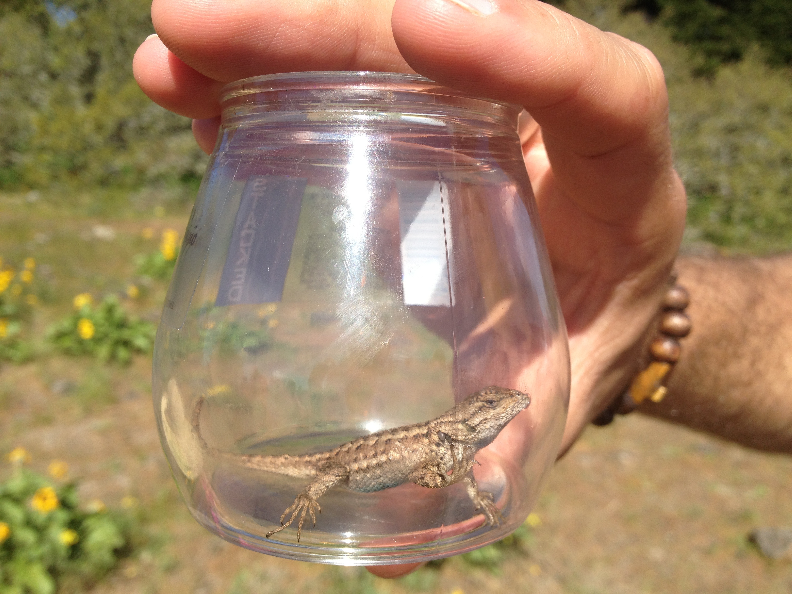 (Thinking this is a Western Fence Lizard; knowing that it is inside an empty Stack Wines glass — great for the trail!)
Kids on Cooper Spur
For starters, let me tell you this: It is completely possible to go backpacking on Mount Hood — or anywhere for that matter — with kids who are 2 and 6 years old.
Let me also tell you this: it is not easy.
And thirdly, I will say this: backpacking on Mount Hood with kids is not easy, but it is worth it. Entirely.

We started our recent excursion with a night up at the Cloud Cap Saddle Campground, where we explored the remnants of the Gnarl Ridge fire, which came close to roasting not only the campground but also the historic Cloud Cap Inn, the Snowshoe Club Cabin, and a few other irreplaceable gems back in 2008. Thankfully, crews back then were able to halt the fire just outside the historic structures while also allowing nature to run its natural course.


The next afternoon, we loaded up and started up the trail toward Cooper Spur, quite possibly the best day hike on all of Mount Hood. With Spencer on my back, heading above 30 pounds even before I added any gear and leaning this way and that, I do believe I can say I’ve carried the heaviest and most cumbersome pack I ever will. But the going was slow and steady, and eventually he fell asleep, which added a nice touch of stabilization.
Madeline’s gripes started about 15 minutes up the trail, but a little break and the promise of a stone fort just up ahead kept her spirits in check.

We made the camp site in decent time and set up for an evening of bouldering, sunset and mountain gazing, and simply soaking in the greatness that is life more than halfway up Mount Hood. It sounds relaxing and idyllic, and in a way it was, but let me also say that it was so nice to have an attentive aunt along for the ride.

The next morning, we set out for a little walk up the spur, knowing full well that not all of us would make it. The kids are troupers, to be sure, but all the way up Cooper Spur is not exactly a walk in the woods. It’s tough, it’s scrambling, and it’s a touch dangerous if you’re not completely careful. Even so, when I turned around with them at about 7,600 feet to head back down, I couldn’t help but think: Wow, how cool is that?

I wish I could say that every minute up on Hood was a smile and a grand view, but these pictures, they lie. Or at least they leave out the parts of the trip that weren’t incredible. The burden of the packs, the tantrums, the tumbles off the rocks, the spilled milk . . . But though we may remember those bits of this and any trip, there are other images, like those captured here, that we remember most, that make us smile in retrospect, entirely glad that we made the effort and the trip in the first place.

Mount Hood view — or not
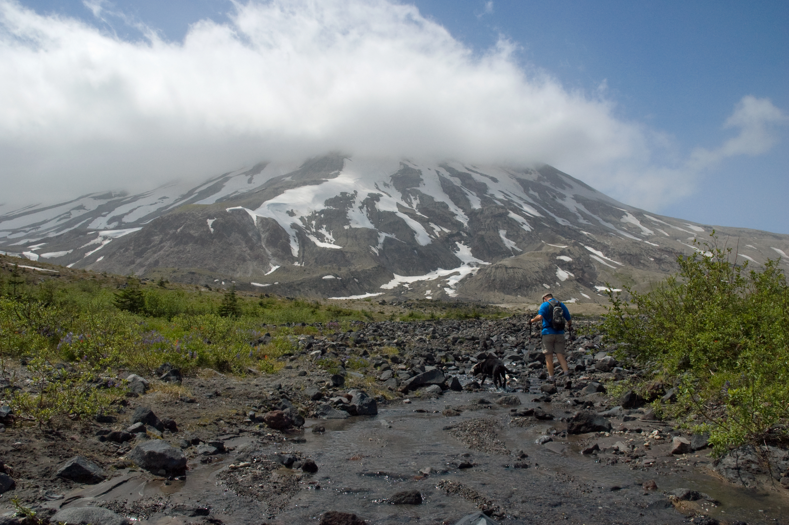
A few weeks ago, back before these hot and sunny days, back in mid July, when morning mist and clouds hung around far too long and blocked true summer’s appearance, my friend, Wyatt, and I headed east in search of some mountain sunshine. And we found it. Not, however, on Mount Hood.

Instead, we drove out of a Portland drizzle, Hood socked in behind a curtain of gray, and made our way over and up to the east side of Mount St. Helens. Up there, at Ape Canyon and all the way up to the Plains of Abraham — 13 miles roundtrip for us — we caught plenty of blue sky, sunshine, and giant if only partly cloudy views of the mountain.
The next weekend, it was still gray in town and there was April-like rain in the air. Still, we headed out, for if you only ventured out on clear, bluebird days, you’d surely be missing too much. This time, we headed to Hood and a standby favorite: Zigzag Mountain via Burnt Lake.
The clouds lifted once for a nice far-off view of the mountain about halfway up and then just again — just — before we topped out. (Look hard. It’s there.)

We didn’t get much else in terms of mountain views that day, but I’m not sure we really needed much more. Sometimes just being out and about, rambling in the hills, is more than enough.

Memaloose Hills Loop Trail
Today, resident Mount Adams expert and photographer Darryl Lloyd sent out an interesting map of a unique and unofficial wildflower trail out in the Columbia River Gorge in between Hood River and the Dalles. I’ve never done it, myself, but it sounds pretty nice — and it’s got at least one incredible view of Mount Hood along it’s 6.5-mile way. Thanks for sharing Darryl!


Mount Hood from Marsh Hill.
Climbing Mount Hood — or not
Last year, when I signed up for the annual Lake Run 5K, I kind of positioned it as part of some training to get myself in shape for a possible climb of Mount Hood. It was just before the release of On Mount Hood, so a climb up the namesake mountain seemed in order.
But I never ended up getting around to it. No valid excuses, really. Sure, the weather last year was lame, I was busy with the family, the book, life. But if you want to climb Mount Hood, or any mountain, really, it’s usually more a matter of making it a priority, focusing on it, making it happen. I’ve climbed Mount Hood four times before, but I never made it happen last year.
This year’s not looking great, either. We have been doing some hiking, I’ve been running, and I again signed up to run the Lake Run. But climbing Hood, for me anyway, takes some more dedication, some stout training hikes like Dog Mountain and, the real test, Mount Defiance. I don’t know if I’m going to be able to focus like that this season, as much as I want to.
But it’s still early. The snow’s still deep up high on the mountain. There’s still a chance. There’s always still a chance.

View from the summit of Mount Hood, June 2010.