The End of Summer on Mount Hood
Well, not officially, anyway, but it was the last official weekend before the start of school, so that’s a kind of ending at least.
We sent the last school-free part of summer off in style with a weekend on the mountain at our regular Sandy River hot spot. Surprisingly, not only was one of the prime campsites actually available on Labor Day Weekend, but it actually wasn’t a pigsty when we rolled up. The stars were aligned for us, I suppose.

The rain did little to dampen the spirits, nor could it interfere in the slightest with all the huckleberries that needed picking.

The sun returned in time for an afternoon hike along the Sandy River toward Ramona Falls.
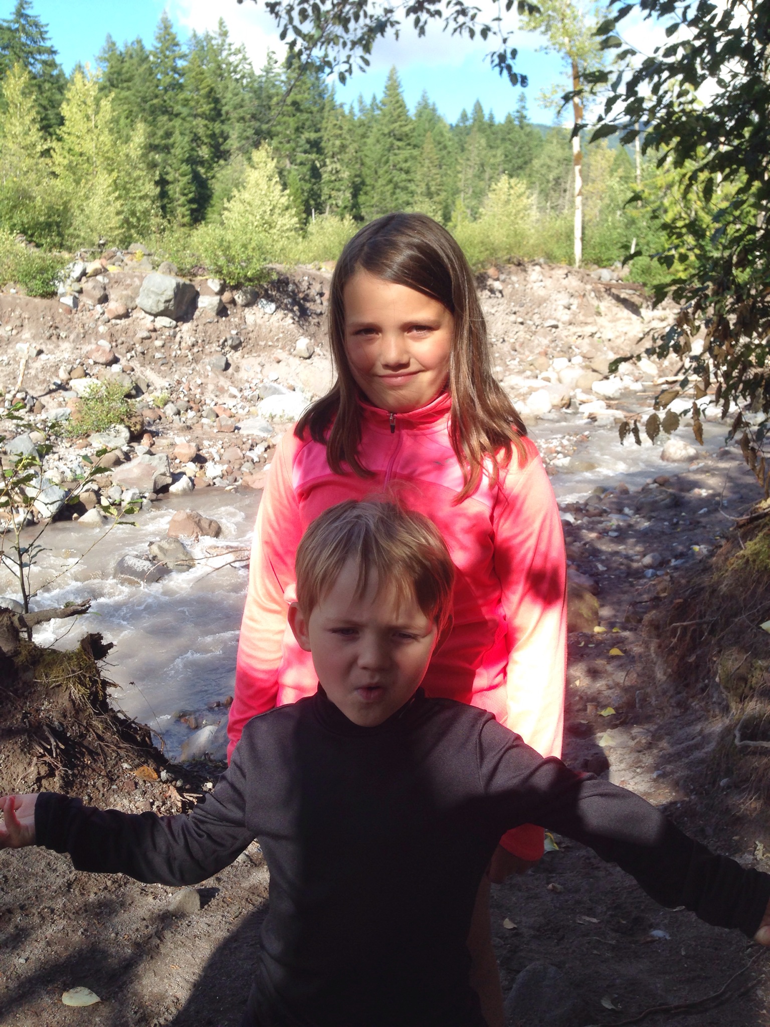
We didn’t make it to the falls — hadn’t planned to — but turned around where the trail crosses the Sandy River. It was here, a few weeks ago, that a flash flood washed out a bridge, swept away one hiker and stranded 23 others.
We tried not to dwell on that too long but instead enjoy the walk and the woods and the water. We did.
The last few hours of the weekend we spent up at Timberline Lodge, where the Mountain Music Festival was in full swing. Eli West & Cahalen Morrison offered some sweet old-time harmonies, while the Black Lillies, who we’d just glimpsed at Pickathon last month, brought some tasty country flavor to the high alpine meadows surrounding the lodge.
Not a bad way at all to (kind of) end the summer, though it’s not truly over yet . . .

Saving the Sandy River
The Sandy River starts high up on Mount Hood as runoff from the Reid Glacier, gathering side streams and the Salmon and Zigzag rivers on its way to the Columbia. It’s a wild river that’s played a big role in how we’ve enjoyed the mountain over the years, whether we’ve been crossing it on the Timberline Trail, camping alongside or cooling off in its silty waters high up, or exploring its confluence with the mighty Columbia at the west end of the Gorge.


The Sandy is a river that a lot of people care about, including the Western Rivers Conservancy, which over the past few years has done much to protect the river. In 1999, the nonprofit partnered with Portland General Electric to help restore the Sandy and the Little Sandy, which led, in part, to the removal of the Marmot Dam and returned both rivers to complete free-flowing status. The conservancy has also purchased properties along the Sandy to help ensure its protection.
A few weeks ago, the WRC contacted me to see if they could use one of my Sandy River photos for a commemorative poster they were issuing. The poster commemorated the 50th anniversary of the Land and Water Conservation Fund, which has provided funding to WRC over its decade-long effort to create a wildlife and recreational corridor along 13 miles of the Sandy and the Little Sandy.
The picture they used of mine was from our trip on the Timberline Trail last summer, right when we were crossing the Sandy, Mount Hood in the background, with a Pacific Crest Trail hiker who was four months into his trek.

When I heard about what the WRC has done for the Sandy over the years, of course I sent the picture over right away. That, indeed, is work that’s worth it.

Thunder, lightning and Dollar Lake on Mount Hood
Because of the snow still piled on the Timberline Trail and the looming high clouds above, and just maybe because of the far-off thunder in the distance, I had my eyes focused on my GPS, which was supposed to be guiding us toward Dollar Lake, a tiny tarn tucked into the northwest shadow of Mount Hood. It’s a lake I’ve always wanted to explore but that in 18 years of traipsing all over the mountain, I never have. It’s not that hard to find, but it’s not super straightforward either. No matter, I had my GPS and we would find it.
“There’s a cairn right back there,” said my friend, Wyatt, pointing out a tidy pile of rocks marking a side trail that I’d just completely blown past, Hmmm. Yeah, that’s probably the way.
We’d decided to hike to Dollar Lake on Sunday as a way to have a cooling destination to counter the heat that’d been baking the metro region for the prior few days. Thanks to a quick change in the weather, we didn’t really need the cooling off, but we headed for Dollar Lake anyway, setting out up Hood’s Vista Ridge trail, one of the classic access points to the mountain’s northwest reaches.
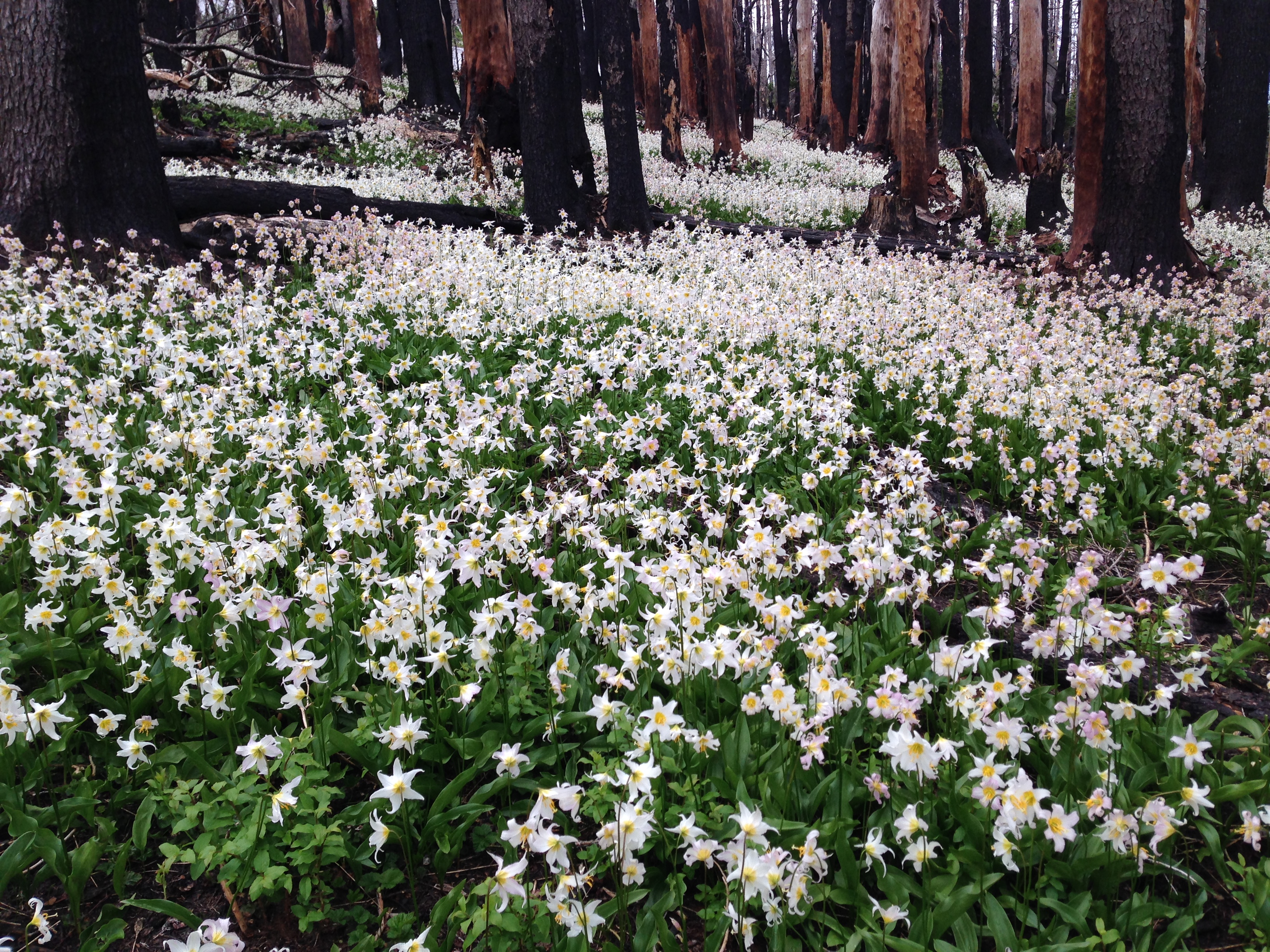
The trail slopes up a scenic ridge marred by the 2012 Dollar Lake fire — marred, or rejuvenated, depending on how you look at it. There were just a few avalanche lilies on display.
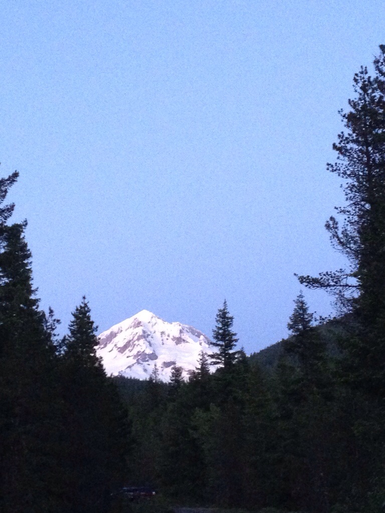
Higher up, we ran into plenty of snow and some ominous clouds, but they were high and the mountain was out, so we pressed on, determined to find the lake.

The GPS pointed us in the right direction, and Wyatt’s keen observation found the trail up to the lake. It was just a ways beyond a sign that brought back a very clear memory from our hike on the Timberline Trail last year. I’ve not written about that yet, but it’s coming.

We thought the lake might have still been frozen over or buried in snow. It was, but only partially. In fact, the lingering snow and ice actually made it even more of a sight than we’d expected.

The views of the mountain from up near this little lake are also pretty amazing.

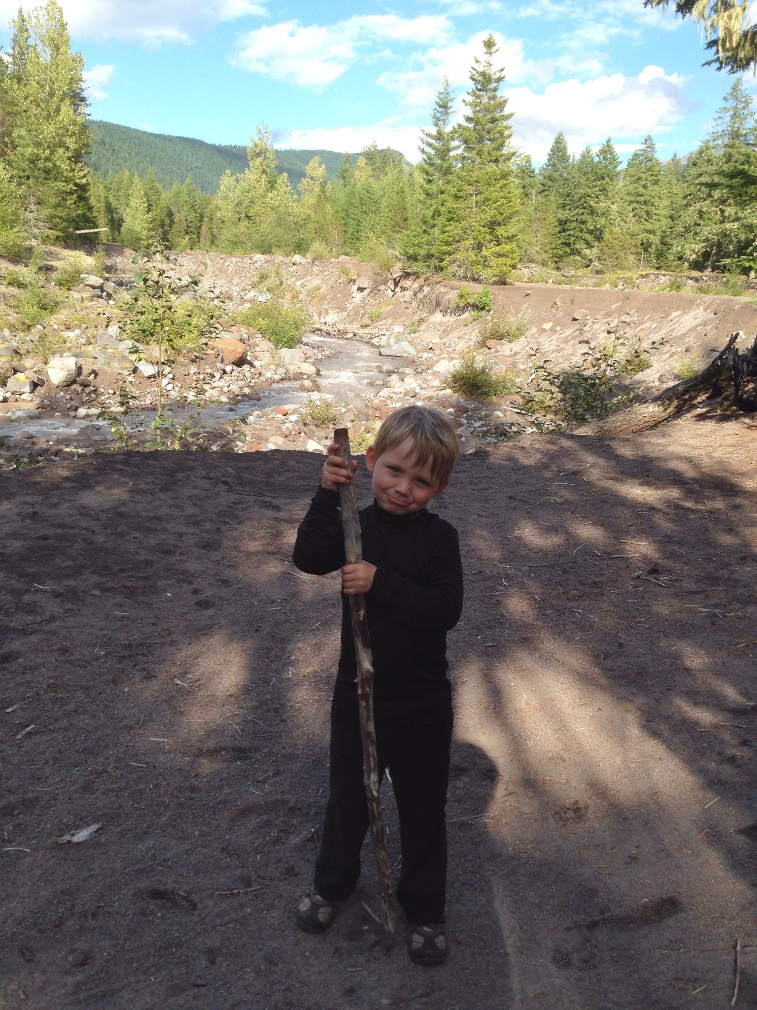
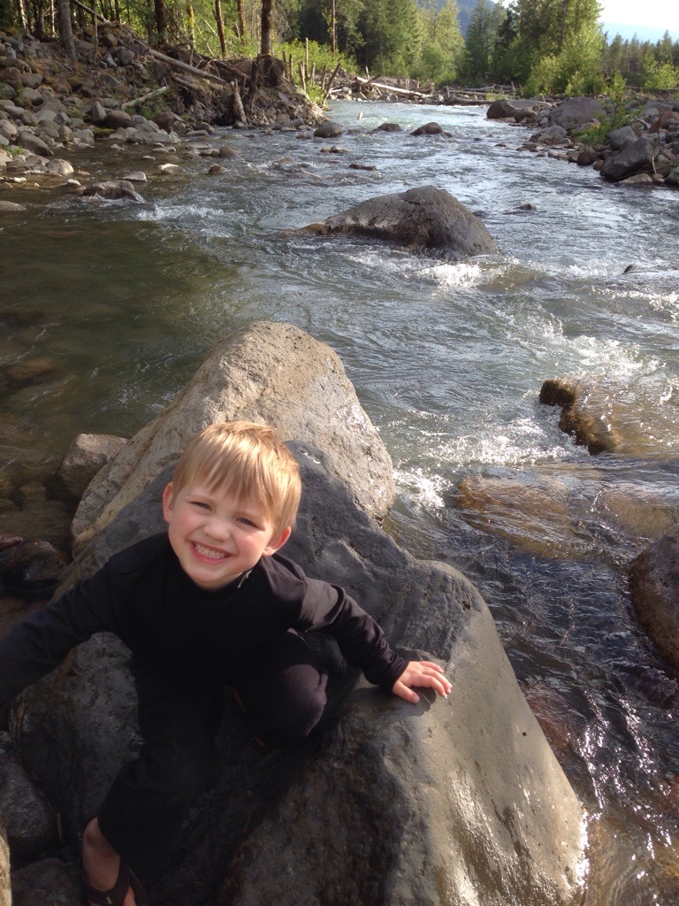
Oliver, too, seemed to enjoy it. I knew he would. He always does.

We didn’t tarry, though. Not only were the mosquitos happy to see what might very well have been their first meal of the season, but the looming clouds and thunder ceased to loom and actually started to rumble. There wasn’t much else we could do other than high-tail it back down the ridge to the car, where the lightning cracked, the hail pelted and the icy lagers refreshed.
This little piggy went to Mount Hood
Summer’s back. Sweet! Sunshine, riversides, campfires, trails and, of course, trashed campsites on Mount Hood.
We headed out for this year’s first night in the tent a few weeks ago, that beautiful first weekend of June that felt like the last weekend of July. Since the Forest Service closed our favorite Sandy River campsites a couple years ago after John Q. Public couldn’t seem to stop using them as trash pits, we’ve branched out a bit and found some other keepers.
Unfortunately, so has John Q.
We spent the first 20 minutes or so cleaning up the pit that the prior campers had left behind: broken glass, cheap beer cans, shell casings, a rusty grill grate, blah, blah. It’s always the same. This site, a nice one with plenty of room, privacy and a killer Sandy River beach, was actually one of the cleaner ones around. It makes no sense to me the way people treat these incredible places. It’s so trashy, so redneck, so downright piggy.
And sometimes it’s just laughably unbelievable.

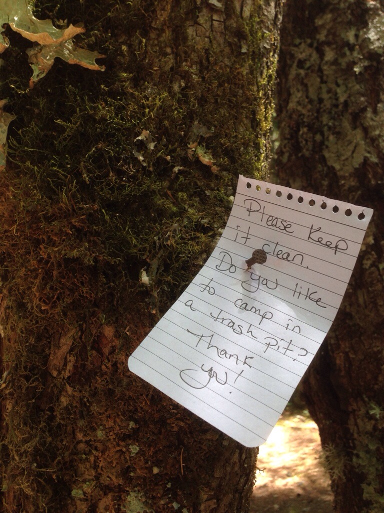
The Forest Service will end up closing these sites pretty soon, too, I’m sure. But no matter. After we’d cleaned ours up, we were able to settle in for a great weekend on the mountain, along the river. We soaked in some sun, hiked for the first time to Little Zigzag Falls and broke in the kids’ new pie iron.


When it was at last time to head home, we packed up and, as most civilized people would do, cleaned the site almost spotless. Almost. We did, after all, leave one thing behind:
Will Mount Hood — aka Wy’east — get the nod?
Wednesday’s the big day, the day Trimet will announce what the newest bridge to span the Willamette River will be called. 
Photos courtesy of Trimet
Portland’s transit agency went through a pretty extensive public process to solicit possibilities, finally narrowing it down to four at the beginning of this year. The finalists: Abigail Scott Duniway; Tillicum Crossing; Cascadia Crossing; and Wy’East. The latter of those is believed to be one of the Native American names for Mount Hood. (I spoke on OPB’s “Think Out Loud” with some other folks earlier this year about the history behind the name.)  Whether or not Hood will get the honor — and whether people will even call the bridge by its technical name or not — Wy’East is still a pretty intriguing name, one with some dramatic Northwest mythology behind it. So, what does Wy’East mean and where did it come from? Here’s how I wrote about it in On Mount Hood, based off research I did, including a reading of C.O. Bunnelll’s 1933 book, Legends of the Klickitats:
According to the lore of the Klickitat, who lived along the north shores of the Columbia River, native peoples used to be able to cross the river over the sacred Bridge of the Gods. (Various landslides throughout time — one as recent as a few hundred years ago — have actually dammed the river and allowed fleeting passage by foot, so this part of the story may not be entirely legend.) Upset by tribes that began to feud, the Great Spirit first doused all sources of fire, save for the one kept burning by an old and ugly woman named Loowit. She would share her flame with those who came in need of a spark. Pleased by Loowit’s kindness, the Great Spirit granted her wish of everlasting youth and beauty. The new dish, however, soon became quite the target, and two of the Great Spirit’s sons, Pahto, who ruled the north, and Wy’east in the south, unleashed a terrible war to gain her affection. They hurled fiery boulders at each other and torched the land all around.
Furious at his offspring, the Great Spirit destroyed the bridge over the river and turned all three of the feuding lovers into volcanic peaks: Loowit became the mountain we know today as Mount St. Helens, Pahto is Mount Adams, and Wy’east is Oregon’s Mount Hood.
On Mount Hood, the Mazamas and the Timberline Trail
Last summer, the morning that we kicked off our 2013 hike around Mount Hood on the Timberline Trail, I had a quick book signing event at Timberline Lodge with a few other mountain writers. One of those was Sonia Buist, a physician whose book, “Around & About Mount Hood: Exploring the Timberline Trail, Access Trails, and Day Hikes,” is one of the most detailed guides for the trail.
She’s giving a presentation on her book at 7 p.m. Wednesday, April 2, for the Mazamas and has graciously invited me to share a few pictures and stories from our epic trip around the mountain last summer. The free event will be at the Mazama Mountaineering Center at 527 SE 43rd Ave.
If you’ve ever wanted to hoof all 41 miles of the Timberline Trail in a single backpacking trip or explore this classic trail in digestible segments, this night should provide information — and inspiration — aplenty.

Crossing the White River on the last few miles of the Timberline Trail, Aug. 2013.